In 2012 we explored the geography of the world through the eyes of Wikipedia and the broader field of fulltext geocoding in "Fulltext Geocoding Versus Spatial Metadata for Large Text Archives: Towards a Geographically Enriched Wikipedia," which was the first effort to apply production-grade fulltext geocoding at scale across the entire crowd-sourced encyclopedia.
As a reminder, the article actually includes links under each figure to the original high resolution figure hosted by the journal itself, so there has not been the link rot of the Culturomics 2.0 and Global Twitter Heartbeat articles. However, in case you encounter difficulties downloading the images, we've provided a mirror below. Feel free to republish any of these maps with credit to "Kalev Leetaru" and a link if possible back to the "Fulltext Geocoding Versus Spatial Metadata for Large Text Archives: Towards a Geographically Enriched Wikipedia" article they come from. There is also a mirror available as well.
- Figure 1: All geographic locations recorded in the GNS gazetteer. [PNG]
- Figure 2: All populated place locations recorded in the GNS gazetteer. [PNG]
- Figure 3: Zoom up of GNS populated place locations in Western Africa, centered on Nigeria. [PNG]
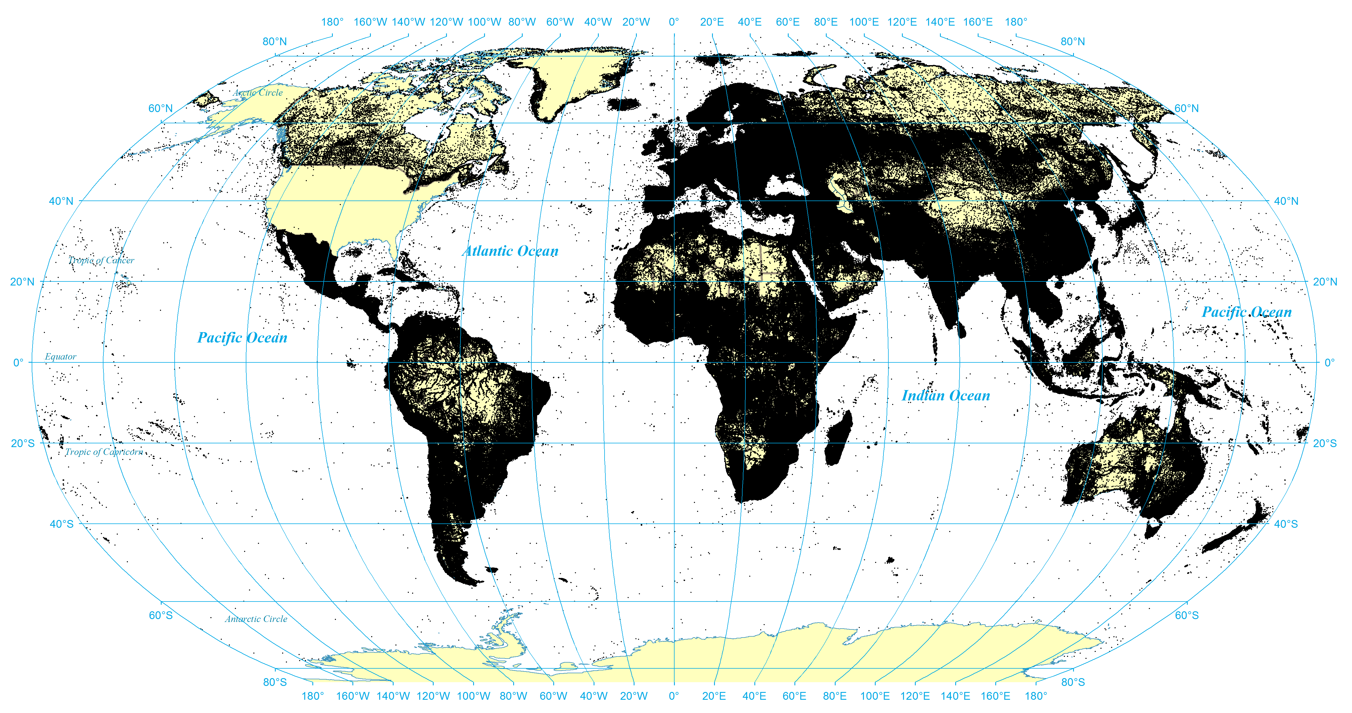
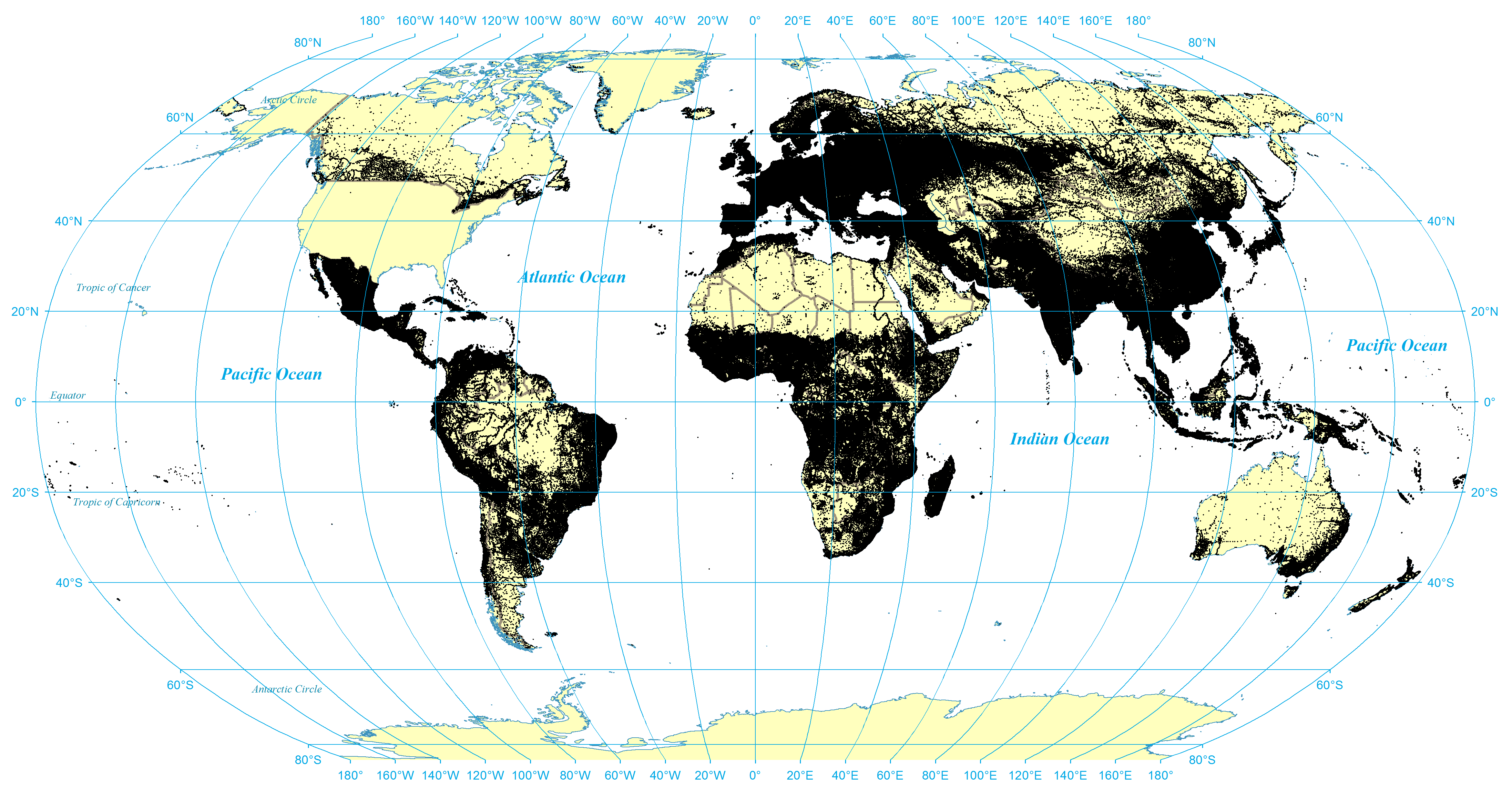
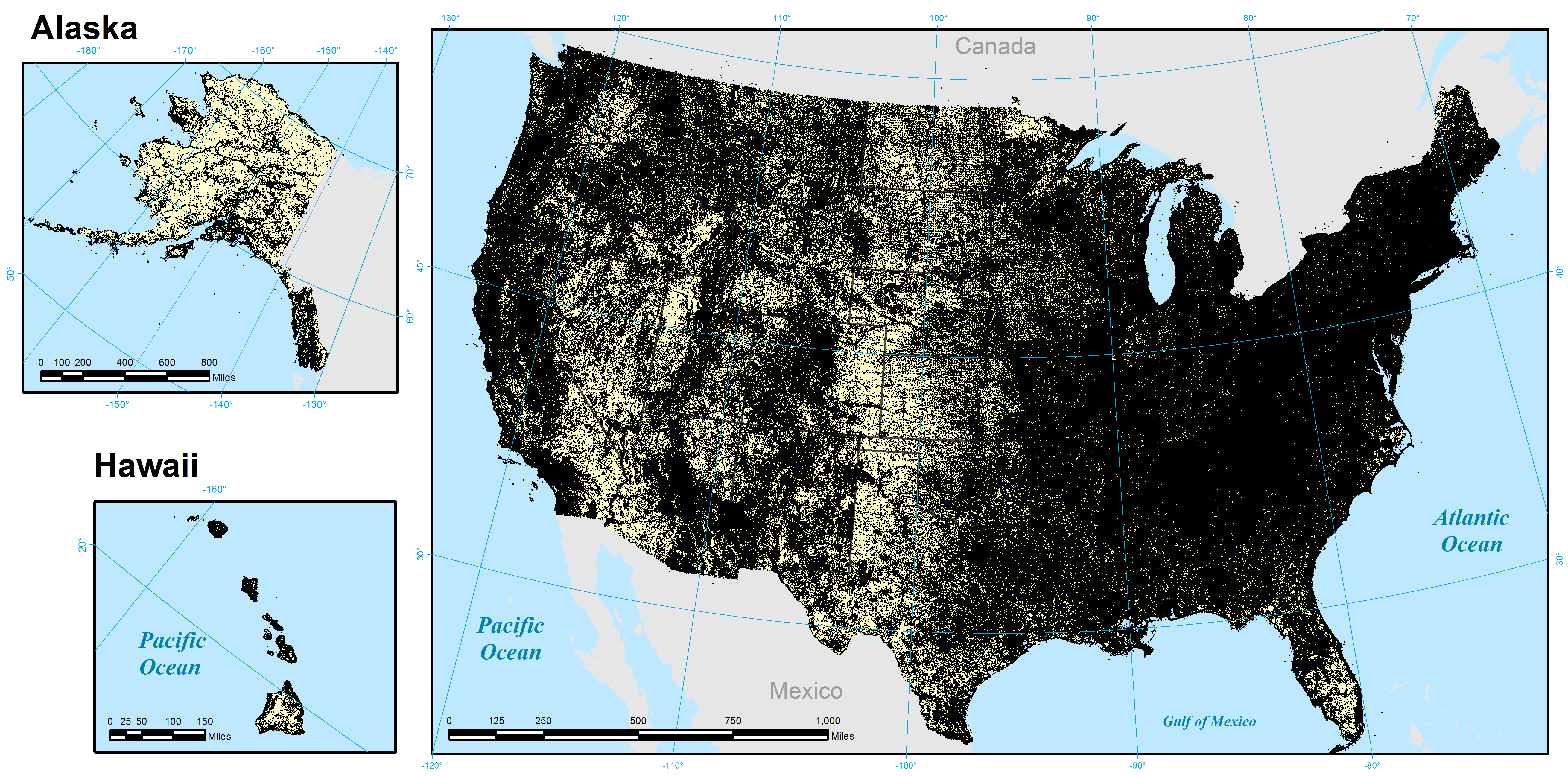
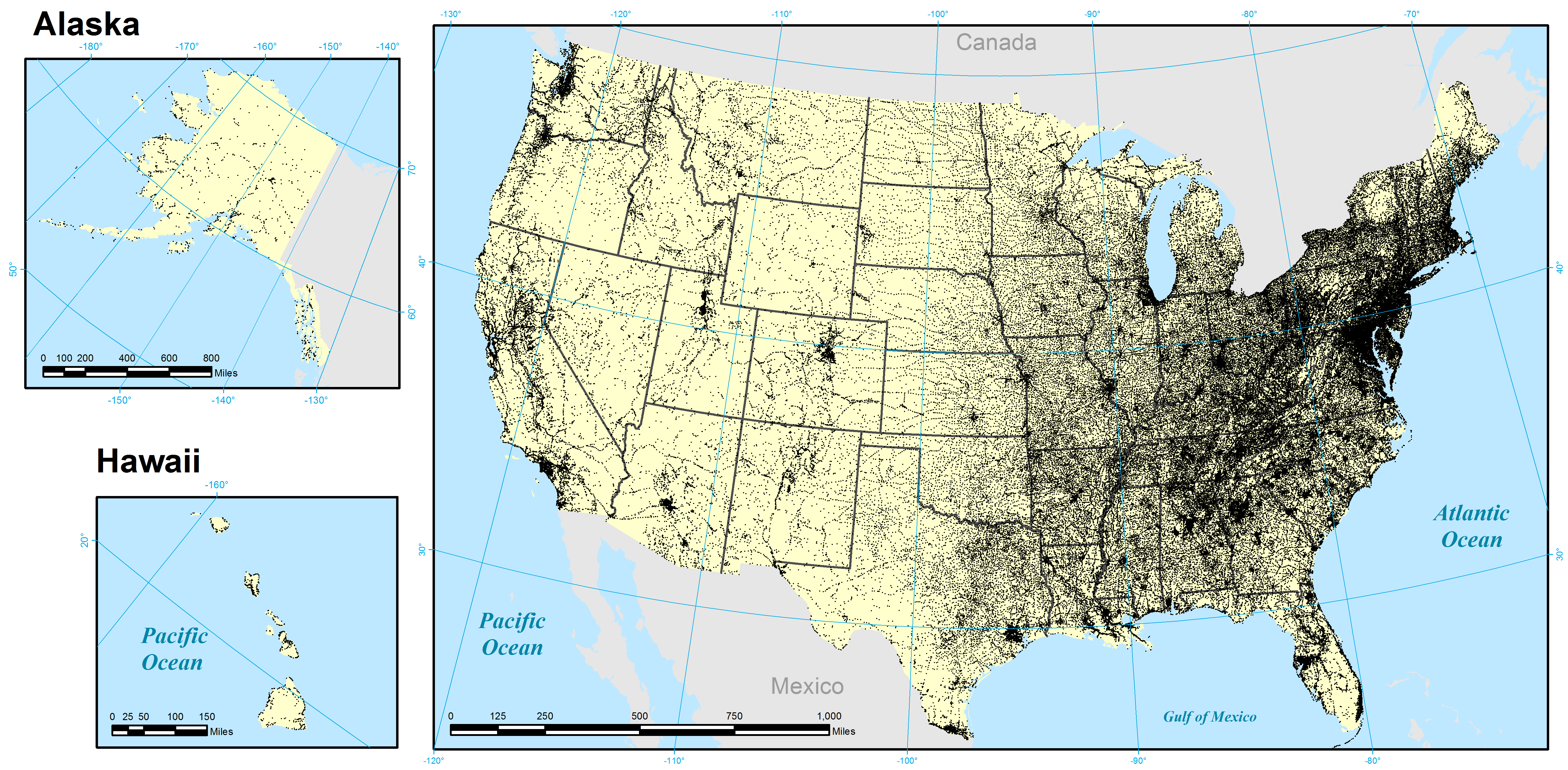
- Figure 4: All geographic locations recorded in the GNIS gazetteer. [PNG]
- Figure 5: All populated place locations recorded in the GNIS gazetteer. [PNG]
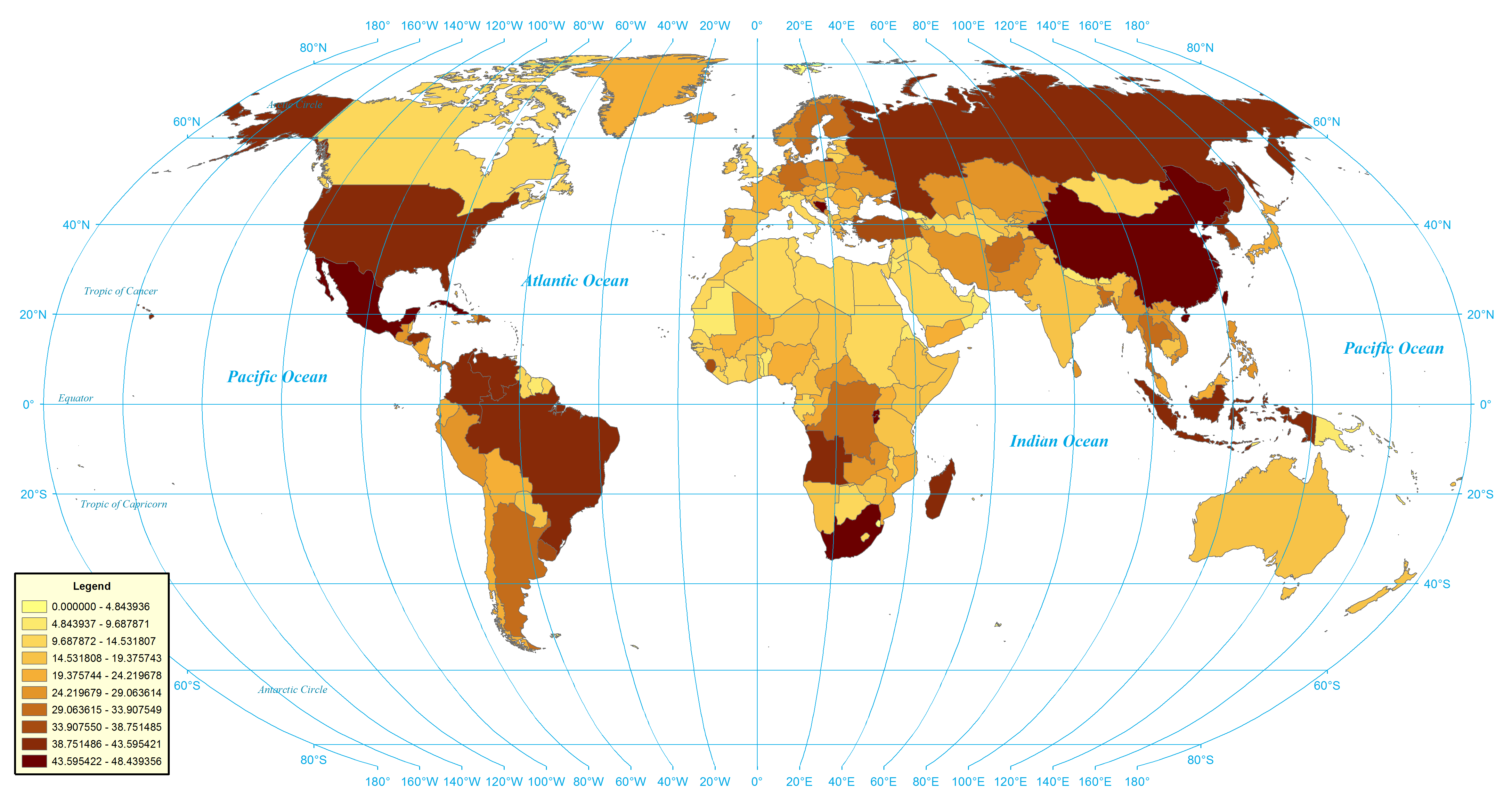
- Figure 6: Percent of locations in each country that share their name with one or more other locations in that same country. [PNG]
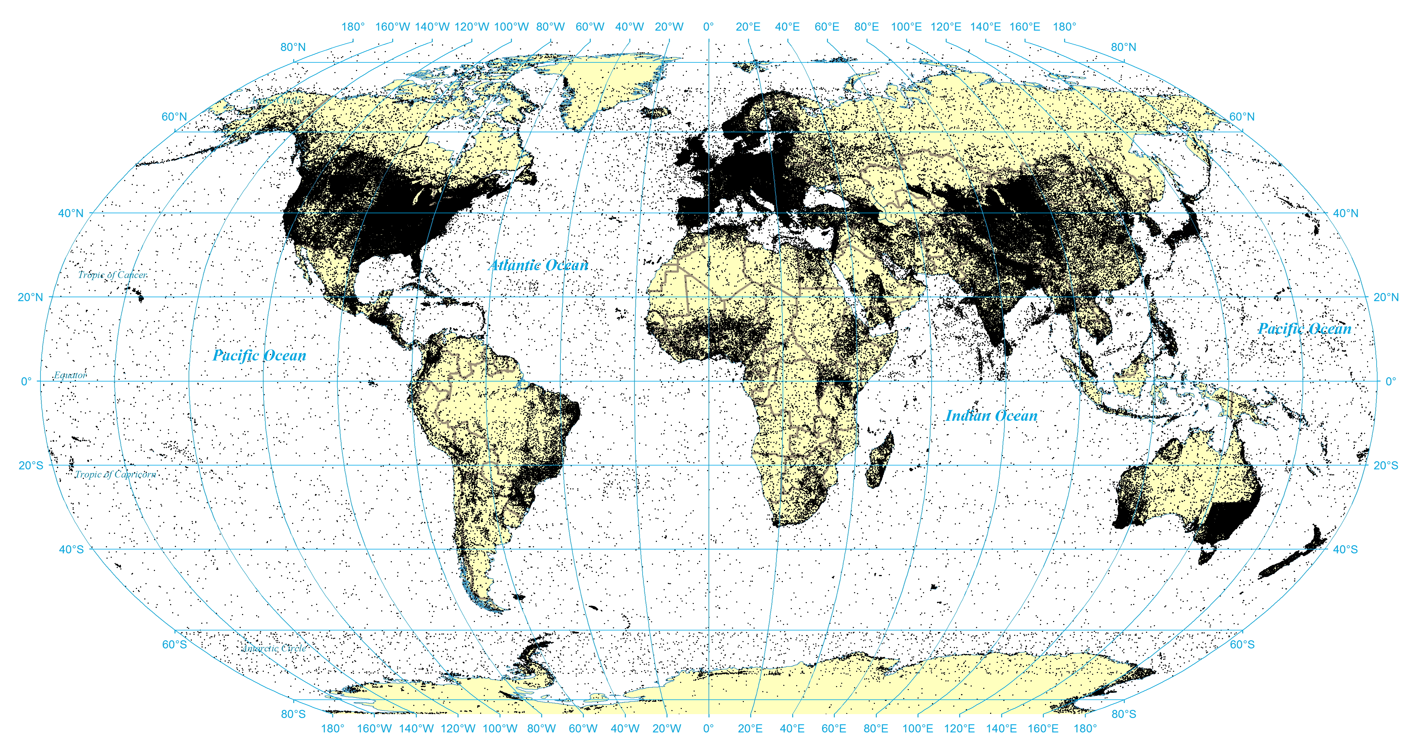
- Figure 7: Geotagged coordinates in English Wikipedia. [PNG]
- Figure 8: Geotagged coordinates in top 40 Wikipedia editions with more than 100,000 articles. [PNG]
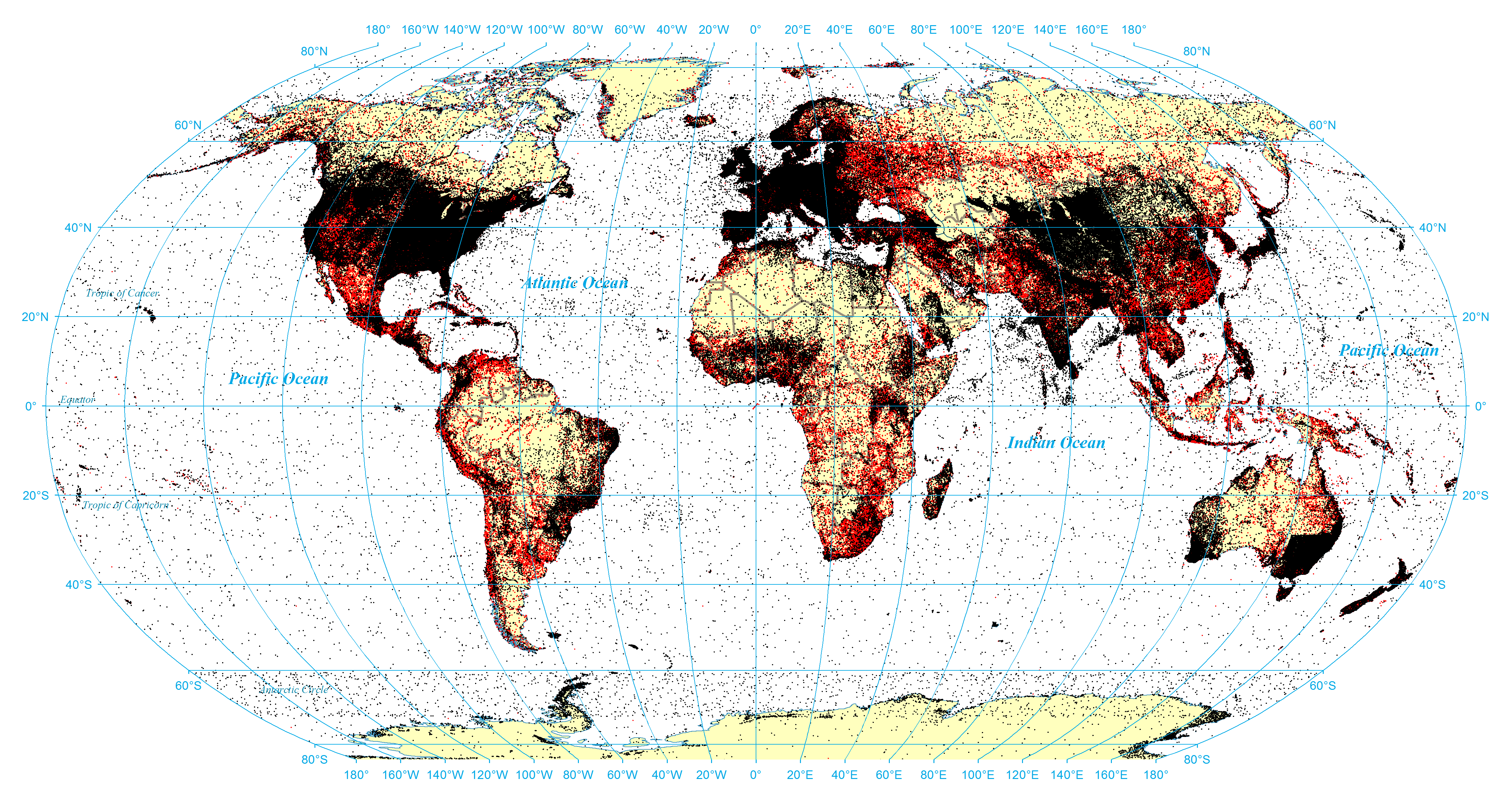
- Figure 9: Comparison of geotagged coordinates with fulltext geocoding coordinates (black are points covered by hand tagged or both / red are points covered only by fulltext geocoding). [PNG]
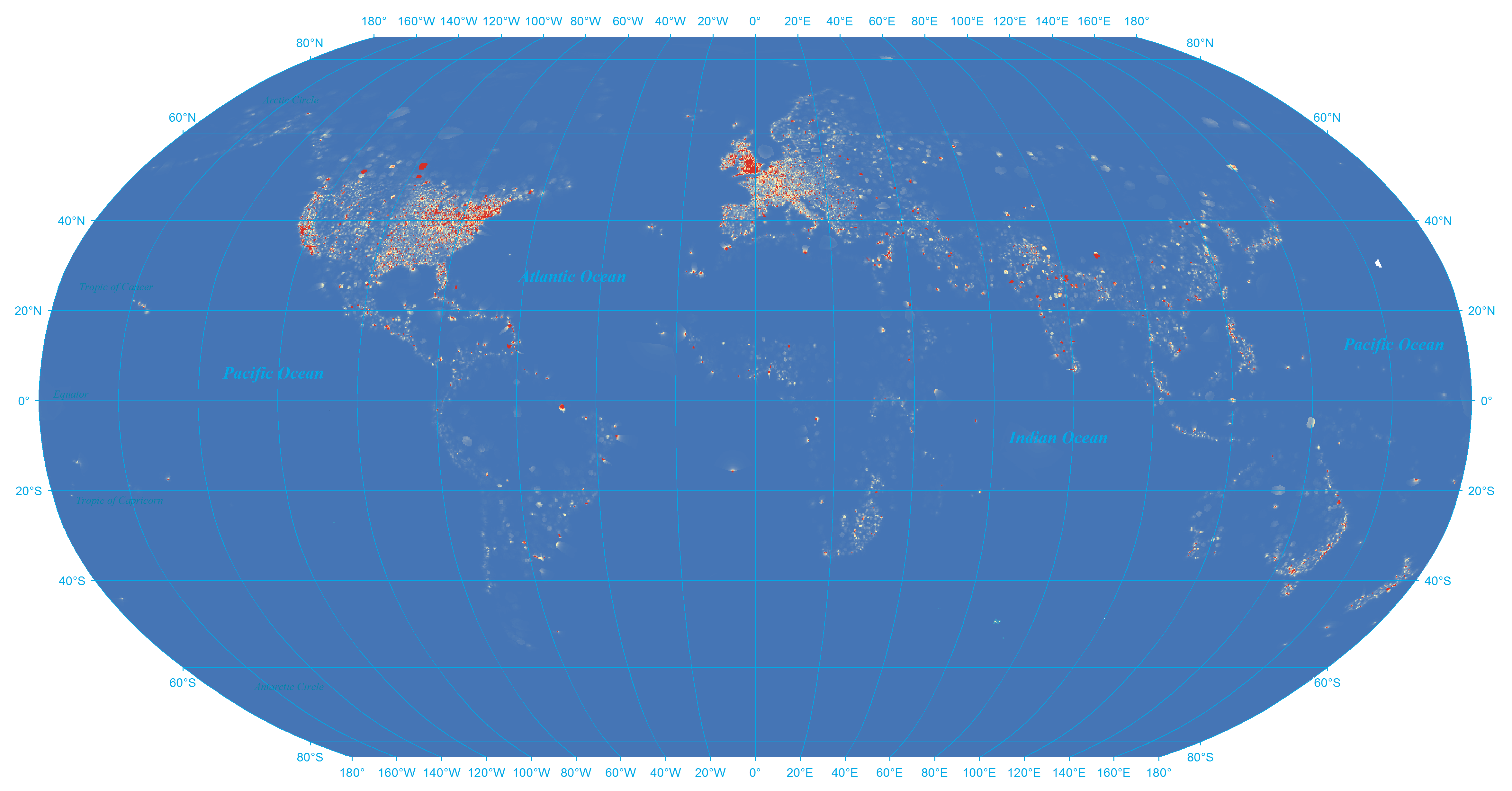
- Figure 10: Density heat map of hand-tagged locations. [PNG]
- Figure 11: Density heat map of fulltext geocoding results. [PNG]