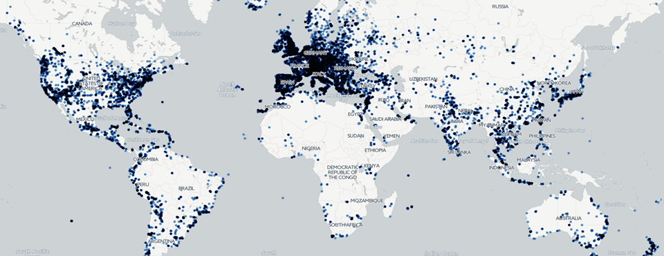
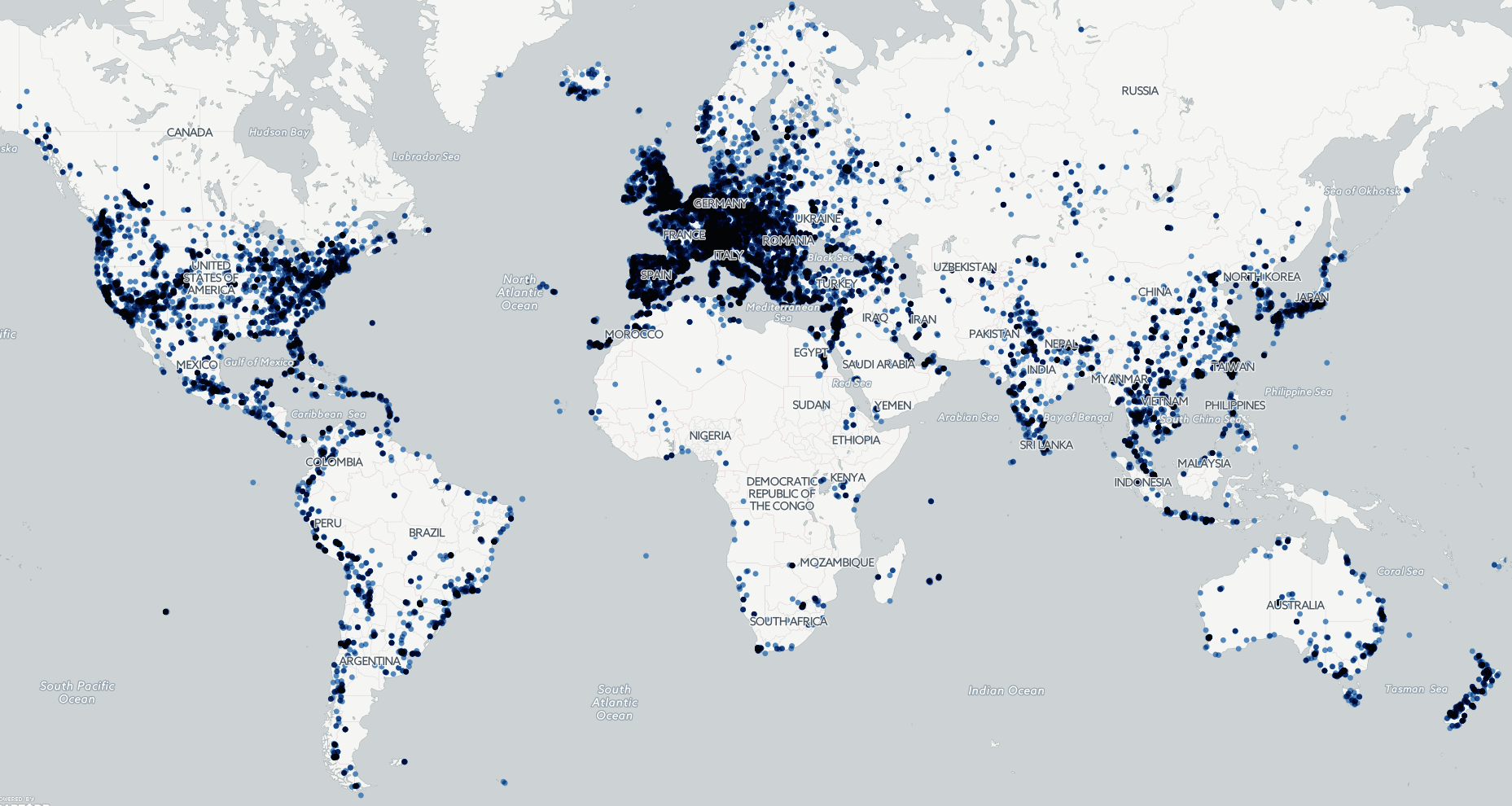
To showcase the power of the new Visual Global Knowledge Graph (VGKG), which reached 19.6 million images as of March 1st, we decided to map all of the images for which the Google Cloud Vision API was able to determine the geographic location depicted in the image, resulting in a map of more than 336,000 images covering almost 37,000 distinct locations on earth. You can read the Forbes article describing the analysis in more detail and some of the major findings.
Click on the image below to launch the interactive clickable map. Click on any location to see the first 50 images determined by Google's deep learning algorithms to depict that location and click on any of those images to view the source article they were found in.
TECHNICAL DETAILS
To create the map, the following SQL query was run on BigQuery to export all of the geolocation data to date from the "cloudvision" table.
SELECT DocumentIdentifier, ImageURL, GeoLandmarks FROM [gdelt-bq:gdeltv2.cloudvision] where GeoLandmarks is not null
Once the query has successfully completed, save the results as a CSV file to your local computer (this may require doing an "Export Table" and saving to GCS as an intermediate step due to the size of the data being exported). Once you've saved the export to your computer, name it as "IN.csv" and download the "parsecloudvisionbqcsvtogeojson.pl" PERL script to the same directory and run it. After a few seconds it will output a file "OUT.geojson" that you can then import directly to CartoDB and create the map above! Happy Image Mapping!