Category: Uncategorized
Full Text Search API Now Offers Image Collage Display Mode
The GDELT Full Text Search API now offers an exciting new output option that generates a thumbnail collage of the…
Places & Spaces XI 2015: Macroscopes for Interacting with Science
We are tremendously excited and honored to announce that GDELT was selected as one of just four macroscopes to be…
An Infinite Stream of Content: How GDELT is Translating the World’s News
Through its Translingual program, GDELT operates one of the largest streaming machine translation deployments in the world, live machine translating all global news…
Wildlife Crime Tech Challenge Prize Winner
We are truly honored and humbled to have been selected as a Prize Winner in the Wildlife Crime Tech Challenge,…
World Economic Forum's Global Risks Report 2016
We're tremendously excited to announce that GDELT was featured in the World Economic Forum's 11th annual Global Risks Report 2016….
GDELT At Structure Data 2016 in San Francisco
Come listen to GDELT Founder Kalev Leetaru speak about what it takes to compute on the entire planet at Structure…
Bustle Magazine Features Candidate Television Tracker
Bustle Magazine recently used GDELT's 2016 Candidate Television Tracker, which uses data from the Internet Archive's Television News Archive, to comment on…
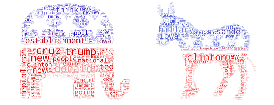
2016 Candidate Word Clouds Extended Back to January 2015
We're excited to announce that our 2016 candidate word clouds have now been extended back to January 1, 2015! They…
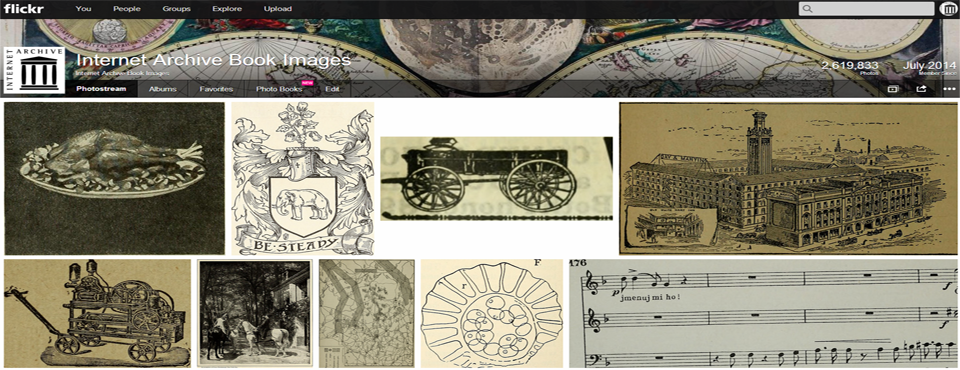
A Year And A Half Of 500 Years Of The World's Book Images
Just under a year and a half ago, in August 2014, Kalev debuted the Internet Archive Book Images collection, a…
2016 Candidate Word Clouds
As part of our ongoing experiments in how to represent the firehose of data that GDELT monitors each day, we've…
GCAM Reaches 40 Dictionaries
We're excited to announce that with the most recent flurry of new dictionaries added over this past week, GCAM now…
Detry, Lopo & Hogenraad Portuguese Emotion & Pro-Social Available in GCAM
We're excited that Brigitte Detry, Teresa Lopo and Robert Hogenraad's Portuguese dictionary of affective values is now available in GCAM….
Regressive Imagery Dictionary: French, German, Hungarian, Portuguese, Russian, Swedish
We're excited to announce that the French, German, Hungarian, Portuguese, Russian, and Swedish versions of Colin Martindale's Regressive Imagery Dictionary…
Hogenraad & Orianne's French Imagery Dictionary Available In GCAM
We're excited to announce that the French Imagery Dictionary by Robert Hogenraad and Etienne Orianne is now available in GCAM. The…
Martindale's Temperament/Elements Available In GCAM
We're excited that Martindale & Martindale's Temperaments/Elements Dictionary is now available in GCAM! This dictionary draws from Bachelard and Greek theory…
Hogenraad's Motive Dictionary Available in GCAM
We're excited to announce that Robert Hogenraad's Motive Dictionary is now available in GCAM! It is available in English, French, and…
NECO Workshop @ ICWSM 2016
GDELT and the Yahoo News interaction dataset are the two datasets for the First International Workshop on News and Public Opinion,…
Heise's Semantic Differential Values Available in GCAM
Heise's Semantic Differential values are now available in GCAM! Published in 1965, these values draw from earlier work by Charles Osgood,…
Hogenraad's TIME Dictionary Available GCAM
Time plays a critical role in how we reason about the world and define events and narratives. Historically most content…
USASOC Futures Forum Briefing
In an update to his May 2015 briefing, Kalev gave a briefing to the United States Army Special Operations Command…
UN My World Survey Topics Added to GKG 2.0
The United Nations My World Survey topics have been added to the GKG 2.0 topical taxonomy as implemented by UNGP with modifications….
Moral Foundations Dictionary Now Available In GCAM
The Moral Foundations Dictionary by Jesse Graham and Jonathan Haidt is now available in GCAM. It scores each article along…
VADER Sentiment Lexicon Now Available in GCAM
The VADER (Valence Aware Dictionary and sEntiment Reasoner) Sentiment Lexicon is now available in GCAM. Unlike the base and NLTK…
The Internet Archive Turns 20: A Behind The Scenes Look At Archiving The Web
Kalev's latest piece for Forbes offers a behind-the-scenes look at how the Internet Archive has evolved over the past 20…
