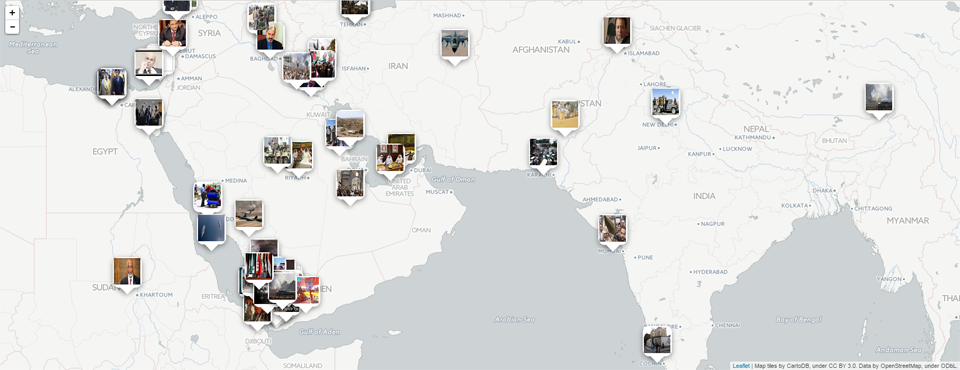
We're excited to announce the debut today of the latest addition to the GDELT Live realtime global dashboard: the new Visual News Map. Geography is often critical to understanding global trends and it can be difficult to make sense of a complex topic or highly fluid evolving situation based purely on textual lists. The Visual News Map provides a unique entrance point to the world's news media by attempting to place image-rich news coverage spatially. For each search, GDELT examines all of the matching news coverage and calculates a spatial grid over the world that computes the total number of mentions of every location on earth, the availability of image-rich news coverage of each location, and the level of detail available about each location. Then, for the top 150 locations with the most mentions in coverage matching your search, GDELT attempts to select an article that captures the situation at that location with respect to your search and displays its lead image in a map popup as a clickable link to that article. At a single glance you gain enormous visual and spatial context to your query. A search for the latest coverage of a conflict makes it possible to instantly see the conflict's visual landscape, from areas of heavy troop presence to active conflict areas to areas not yet engaged in fighting, to peripheral impacts across the region.
Note that this is an extremely complex process and not all results will be accurate. Given the enormous complexities inherent in attempting to tease apart the city-level geography of the world's news media across 65 languages there will often be a fair degree of error in the resulting map, but overall it should offer a reasonable macro-level approximation of the geographic visual tapestry of your search.
To include the Visual News Map in your search results, make sure that "Include Analytics" is enabled to see this map – it will appear between the article list and the Geographic Heatmap.