The GDELT Project

  • The GDELT Project Blog
  • Website

Using AI For Good: A New Data Challenge To Use AI To Triage Natural Disaster Aerial Imagery

 January 20, 2018

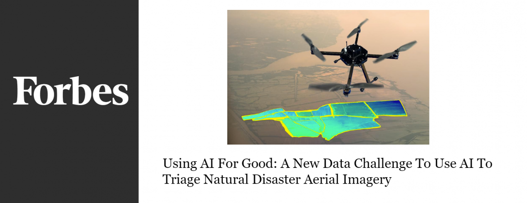
A new collaboration of the World Bank, WeRobotics and OpenAerialMap yields an open data challenge to create AI tools to automatically assess road and agricultural damage from natural disaster aerial imagery, illustrating the incredible potential of deep learning for humanitarian applications.

Read The Full Article.

Post navigation

← The Straits Times: Facebook Reacts To Pressure On Propaganda
BBVA: China | One Belt One Road – What's In It For Latin America? →

Archives

The Official GDELT Project Blog