

Last week we used Gemini to translate the Latin text on the back of Johannes Janssonius' "Nova Totius Livoniae Accurata Descriptio", which offers a mid-17th-century look at the cartographic knowledge of Estonia. At least 13 states are known of this particular map and its accompanying text between 1636 to 1658. Which edition is ours? To date a map like this, you use a map state table published in a relevant reference work: in this case, page 589 of volume 1 of Koeman's Atlantes Neerlandici, which distinguishes the states through the verso text, combining the text language, page number and signature. Let's pretend for a moment that we've never used a state table before and are confronted with a strange list of entries like "1:421/2 (1638-42 German): vl 28 2G / 1:413 (1645-46 French): vl 15 P(2G) / 1:403/05 (1646-57 Latin): vl 8 I(O) 16" that we have no idea how to understand. Can we just give Gemini photos of the map front and back and a cellphone snap of page 589 from Koeman and ask Gemini to read the state table and visually cross-reference it against the map to find which entry refers to our map? Indeed, Gemini passes with flying colors!
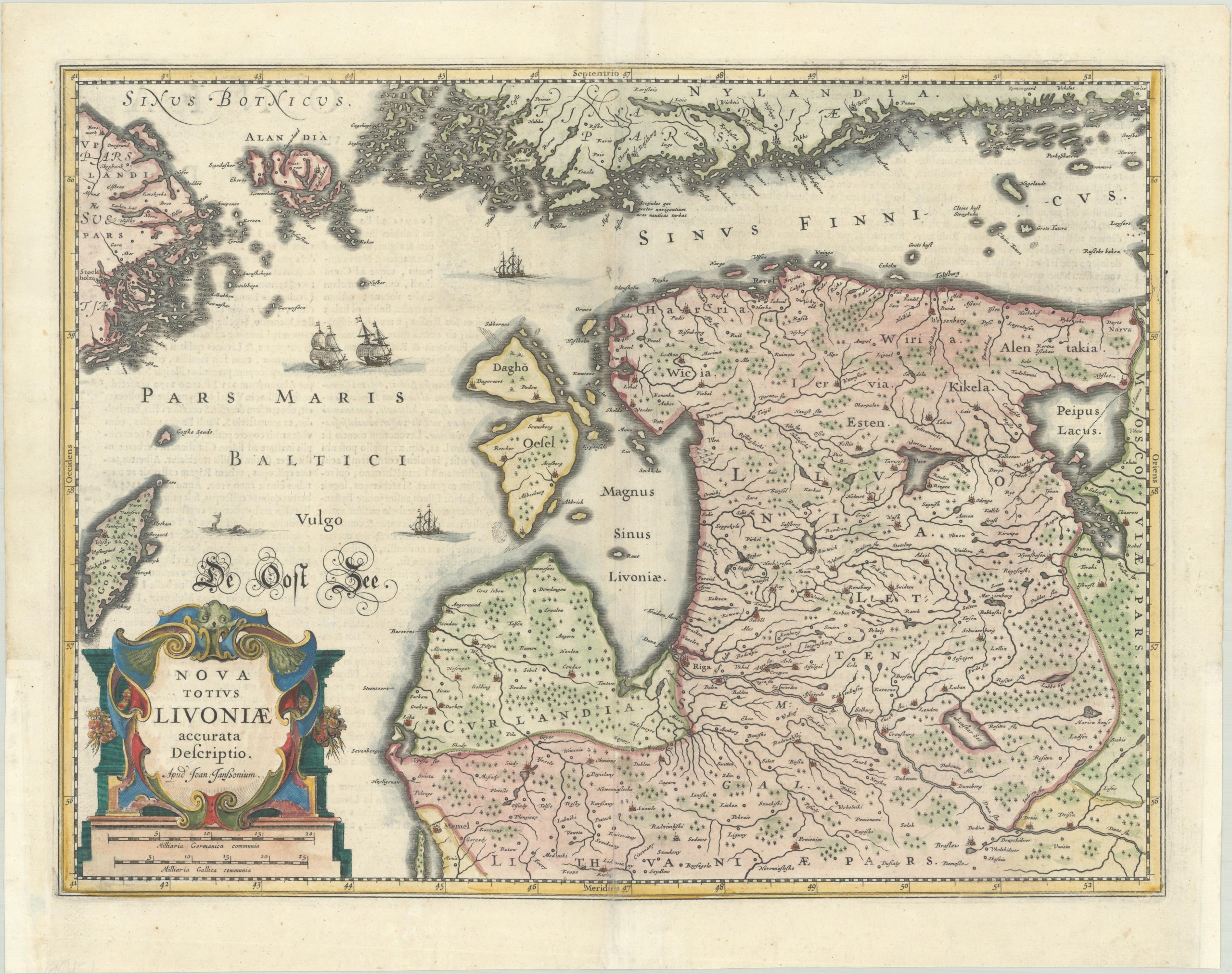
Below you can see the map itself, complete with original contemporary coloring:
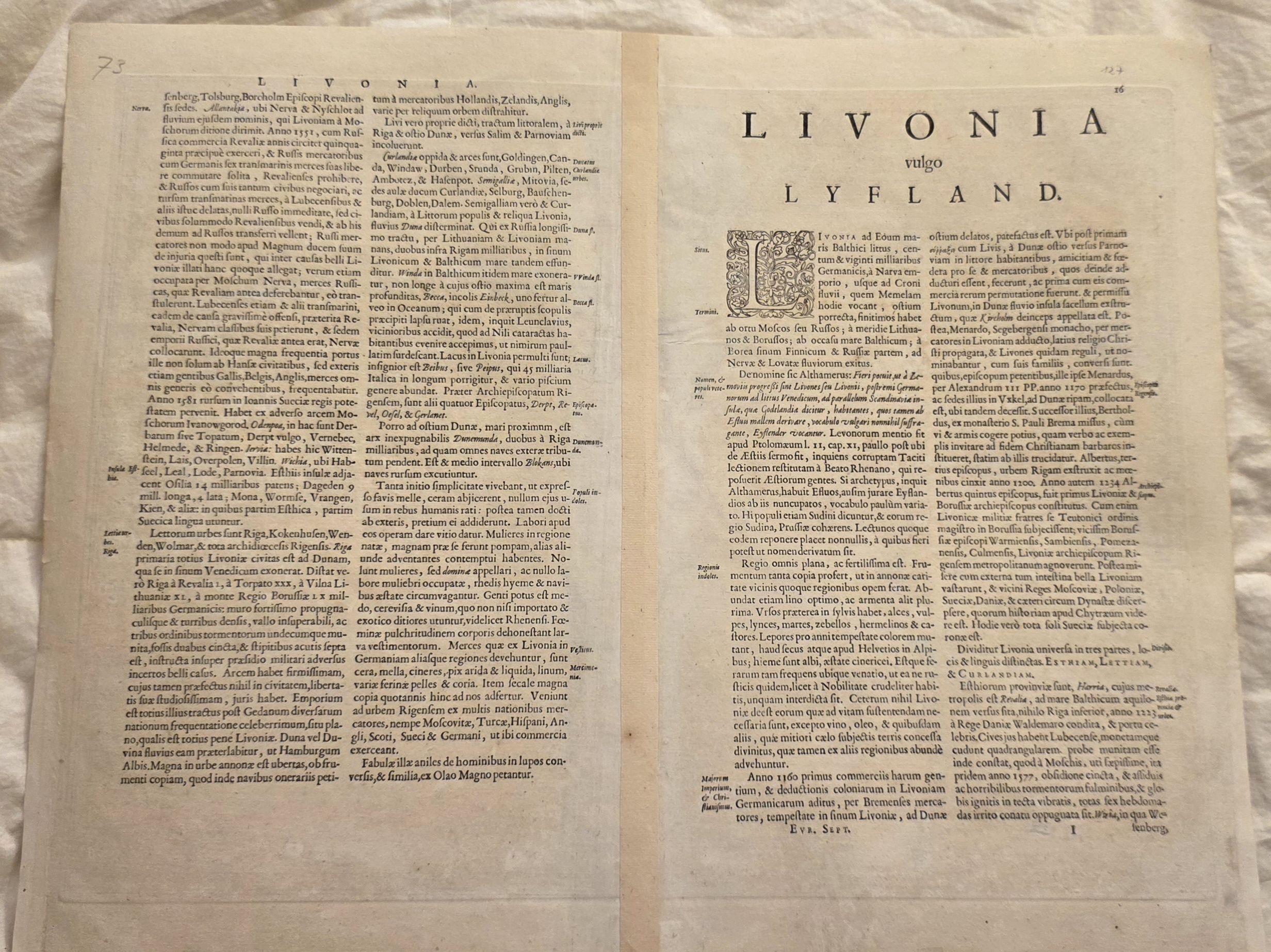
Map state tables typically rely heavily on the verso text to distinguish editions, so here is the original text (see the translation):
Finally, the state table itself that tells us how to determine the date of this specific edition of the map:
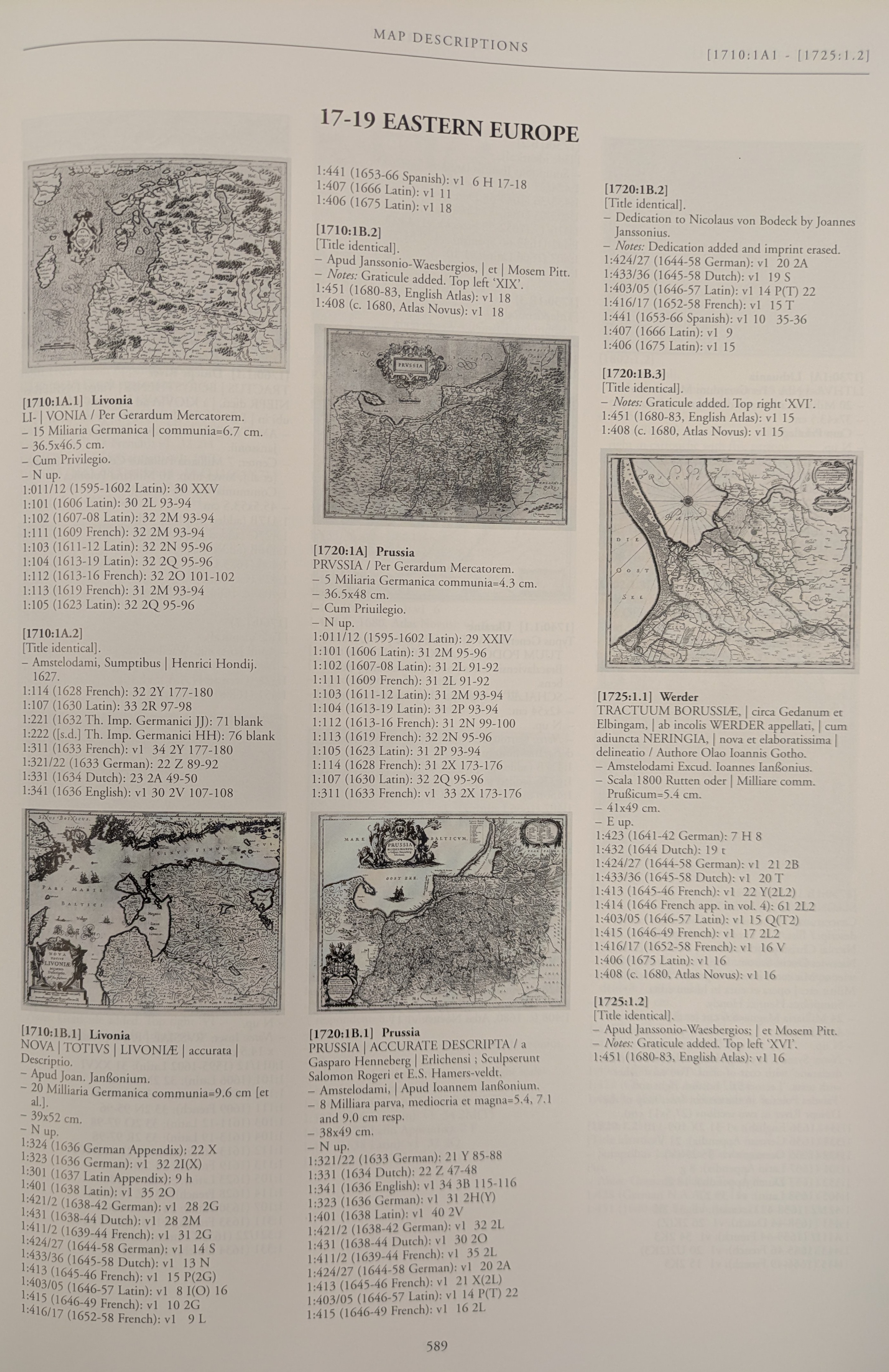
We will give these three photos to Gemini and ask it to determine which edition the map is. Note that we don't even tell Gemini which of the maps on the page is ours – Gemini visually scans the page, identifies the thumbnails of the five different maps, compares each of them to ours and determines that ours is the one in the lower-left:
use this lookup table to determine which date this map is.
Based on the provided images and lookup table, here is the step-by-step process to determine the date of your map:
1. Identify the Map
-
- Look at the title cartouche in the bottom left corner of the map (Image 2). The title reads: "NOVA TOTIVS LIVONIÆ accurata Descriptio."
- Just below the title, the publisher is listed as: "Apud Joan. Janssonium."
2. Find the Map in the Lookup Table
-
- In the reference document (Image 1), scan for the matching title and publisher.
- You will find this exact match in the bottom left column under the section heading [1710:1B.1] Livonia.
3. Analyze the Text on the Back To figure out which specific edition this map belongs to, examine the text printed on the back (Image 3) for key identifiers:
-
- Language: The text is written in Latin (e.g., the title "L I V O N I A vulgo LYFLAND" and the text itself).
- Page Number: Look closely at the top right corner of the right-hand page. Just below a crossed-out handwritten number, there is a printed page number 16.
- Signature Mark: Look at the very bottom right of the text column on the right-hand page. There is a single printed capital letter I. (Printers used these marks to help binders assemble pages in the correct order).
4. Match with the Lookup Table
-
- Return to the list of editions under the [1710:1B.1] Livonia section in the lookup table.
- Scan down the list to find an entry that matches a Latin edition with a signature mark of "I" and a page number of "16".
- You will find this perfectly matching line:
1:403/05 (1646-57 Latin): v1 8 I(O) 16
Conclusion Based on this matching entry in the reference guide, the date of the map is 1646–1657.