We're excited to announce today the debut of the new "showcase" format in the GDELT GEO 2.0 API! This new output format renders the standard HTML map in your browser, but instead of requiring you to click on each individual location to see the image results from that point or country, this format divides your search results into a 5 degree grid and one image is selected for display from each grid cell and displayed in a popup with up to 100 images total displayed on the map. This is particularly useful for presentations and for rapidly triaging matching imagery from across the world. This format is only available for pointdata, country, sourcecountry, imagesourcecountry, imagecountry and imagepoint data modes.
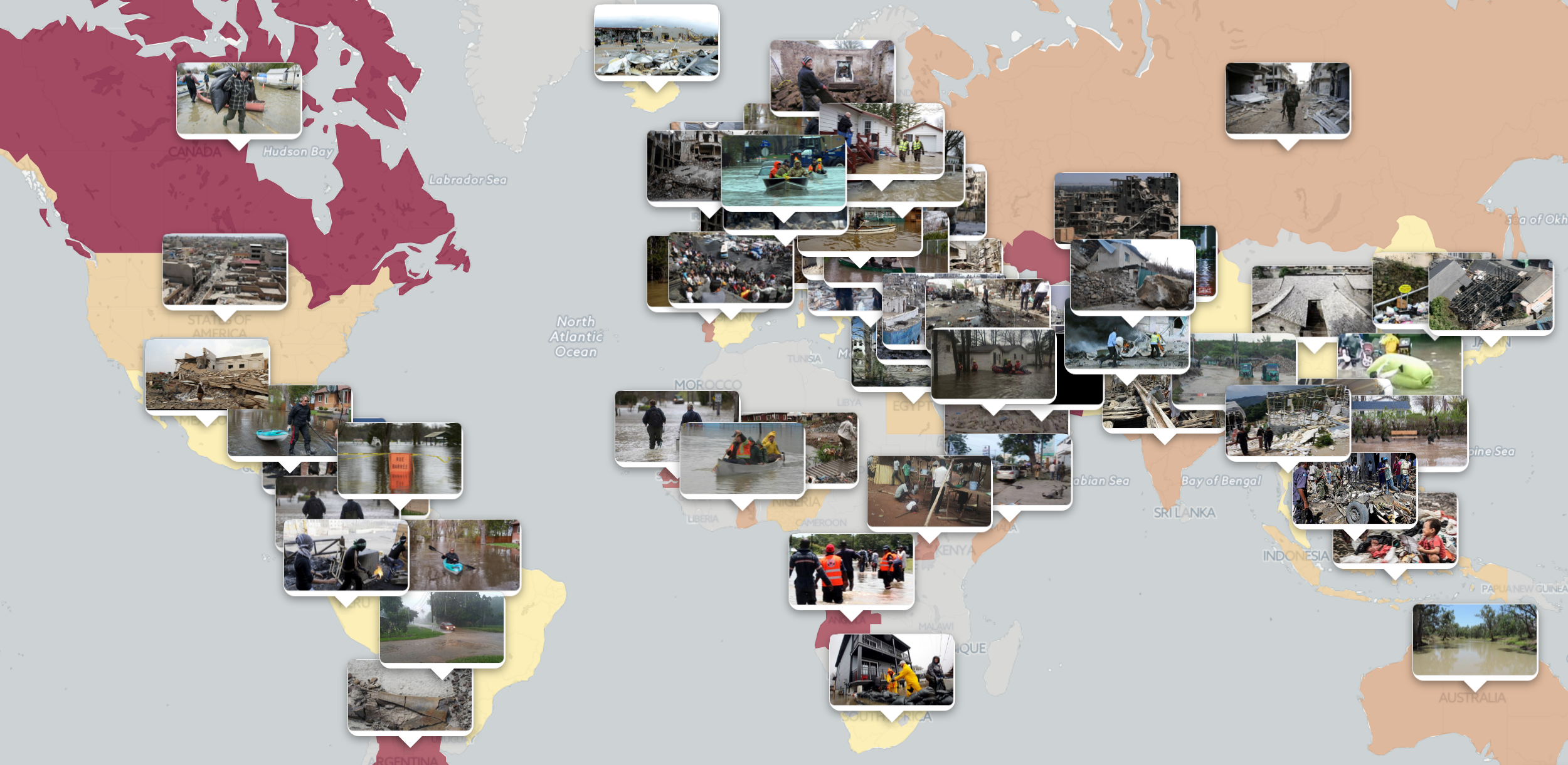
You can see an example of this new format used to map flooding, rubble and earthquake imagery in the image at the bottom of this post.
QUICK START EXAMPLES
Using the new format is quite easy – simply use "imagehtmlshow" as your output format instead of "imagehtml"!
- Showcase Map of flooding, rubble and earthquake tagged images. Shows up to 100 images determined by Google's Cloud Vision API to depict flooding, rubble or earthquake damage. Each image is shown via a popup from the country whose press that image appeared in. Images appearing in a given country's news media could depict events in that country or events from other countries being covered in that country's press.
- Imagery From Donald Trump Articles. Shows up to 100 images from articles whose text contained the phrase "Donald Trump". Note that typically about half of these images will depict Donald Trump himself, while the other half will show either individuals close to him or others in the news in contexts relating to the US presidency.
- Imagery Captioned As Donald Trump. Shows up to 100 images whose captions contained the phrase "Donald Trump", appeared elsewhere on the web captioned as "Donald Trump", contained the OCR'd phrase "Donald Trump" or contained EXIF or other embedded metadata with the phrase "Donald Trump." Note that many of these images depict events or people relating to current events of the US president such as an image of a foreign leader or event that is captioned with Donald Trump's remarks or actions relating to that leader or event. Offers a powerful look at how the world's media are contextualizing a given phrase.
- Imagery From Happy Articles. Shows up to 100 images from articles whose text was scored as being very positive by using the "tone>10" query operator. Note that the resulting images are those that appeared in articles with positive textual contents, but no assessment is made of the image contents itself. Given global media norms, most of the images that appear here are positive or uplifting.
- Imagery From Negative Articles. Similar to the "Happy Articles" example above, but uses "tone<-10" to display up to 100 images from articles whose text was scored as very negative.