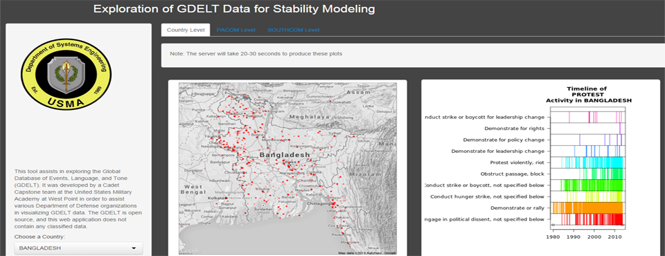
This past June we pointed out an article by researchers at the Department of Systems Engineering at the United States Military Academy at West Point exploring GDELT in the context of “Data Collection, Fusion, and Visualization for Decision Making in Stability Operations.” They've now released a prototype visualization tool that allows you to select from a set of countries of interest and generate a simple point or hexagonal map. It is a prototype tool hosted on a small server, so it can take up to 20 seconds to generate the map, but demonstrates the ability to rapidly map GDELT for stability modeling applications. Check out the PACOM and SOUTHCOM tabs at the top of the visualization for more visualizations of the data.
The work was done by cadets at United States Military Academy at West Point as part of their capstone project under the advisement of Major David Beskow. Take a look at the presentations below for more detail on their broader project, especially their AY2015 project proposal, which includes a range of really powerful analytic focal points, such as influence graphs using the GDELT Global Knowledge Graph!